Recent projects
-
 Read more
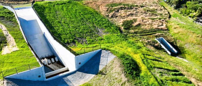
Morey Street Dams and Wetlands
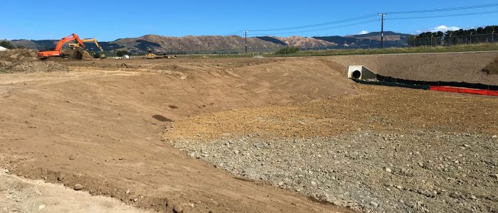
MAP Projects was engaged by Rotorua Lakes Council in October 2022 to undertake the building of two flood detention dams in the Upper Kaipakau Stream catchment to reduce the potential occurrence, extent and impacts of flooding on nearby properties and roads. It also included the establishment of a stormwater treatment wetland.
The project involved the construction of two detention dams (East and West Dams 700m apart) and the treatment wetland...
-
 Read more
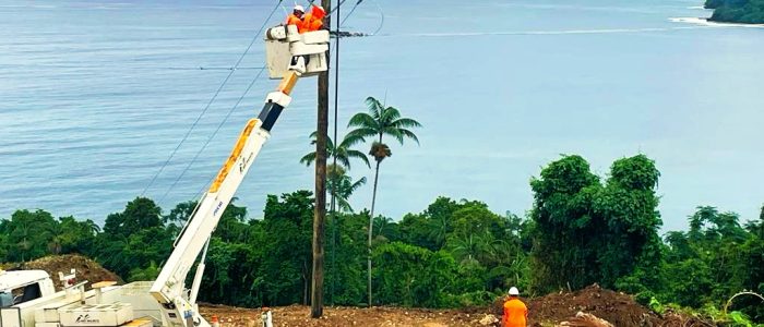
Santo Grid Expansion – Vanuatu
The Santo Grid Expansion involved over 550 poles across 45kms on the East Coast Highway (or “Goodwill Highway”) on the island of Santo Espiritu in Vanuatu. This project is another clear demonstration of the MAP commitment of best for project and Relationship Contracting with the work being directly negotiated with the Vanuatu Project Management Unit.
The project was jointly funded by the Asian Development bank and the Vanuatu government as part of the Vanuatu Energy Access Projects initiative, which aims to increase access to renewable energy on Santo from an existing Hydropower plant...
-
 Read more
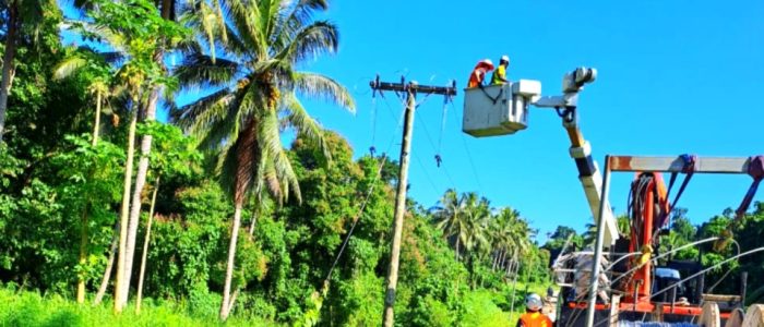
Malekula Transmission Line and Grid Expansion – Vanuatu
The Malekula Transmission Line was awarded as a part of the Vanuatu Brenwe Hydropower Station as there was no infrastructure in place to carry power from the new Brenwe Hydropower station to the existing grid and 9 new villages (populations between 200 and 2500), and MAP were one of the few contractors with the capabilities to complete a quality job.
The project was jointly funded by the Asian Development bank and the Vanuatu government as part of the Vanuatu Energy Access Projects initiative, which aims to increase access to renewable energy on Malekula.
Big shout out to Construction Partner Independent Line Services (ILS) who provided the design effort and the technical skills and training for the Conductor install in this similarly challenging and remote environment...
-
 Read more
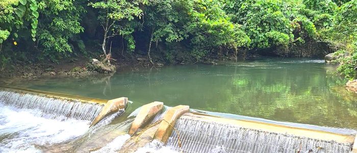
Brenwe Hydropower Station – Vanuatu
The Brenwe Hydropower Station is a Design and Construct, new build Hydropower Scheme in Malekula, Vanuatu. This was funded by both the Asian Development Bank and the Vanuatu government.
The run of river scheme is comprised of an 18m wide concrete weir with fish passage which takes water via Coanda screens into 1km of large diameter (900 to 1100mm) glass reinforced pipes (GRP) Headstock...
-
 Read more
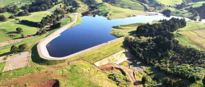
Matawii Water Storage Reservoir
Matawii Water Storage Reservoir was constructed by MAP for Te Tai Tokerau Water Trust, with the primary objective of supplying Kaikohe with water for irrigation, which will create sustainable employment opportunities in horticulture and agriculture for the surrounding regions. It will also be back up for clean, reliable drinking water
The reservoir, a zoned embankment structure, stands up to 24 meters high and stretches over 550 meters in length. Given its elevation and proximity to Kaikohe, it is classified as a High PIC reservoir, demanding the highest design, construction, and operational safety standards for the community’s welfare...
-
 Read more
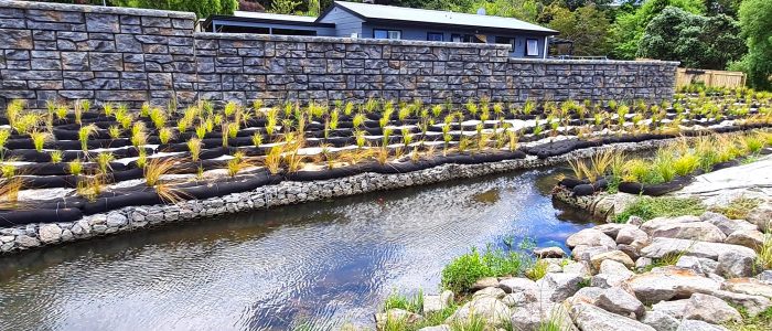
Esmerelda Street Flood Mitigation
MAP Projects was engaged by Tauranga City Council to complete a fiddly floodwall and flood mitigation project on a negotiated basis. The Esmeralda Flood Mitigation Project involved the placement of some 168m of Redi-rock flood wall up to 4m in height.
The works also included the placement of significant areas of rock protection, stream channeling Gabion baskets and services locations...
-
 Read more
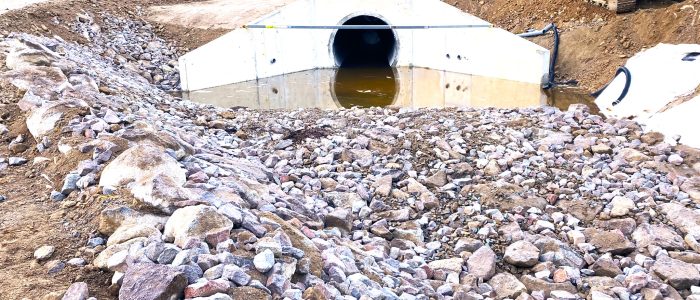
Nanako Stream Stormwater Upgrade
MAP was engaged by Tauranga City Council in a multi staged ECI with the aim to effectively manage stormwater catchments, mitigate potential flooding events, improve water quality and accommodate future planned developments in the area. The completed B1/2 Separable Portion involved upgrading the existing Kennedy Road embankment to meet current dam safety design standards, reduce the risk of dam failure and provide flood mitigation. The project installed a 2...
-
 Read more
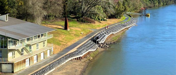
Waikato River Works
MAP Projects was engaged by Hamilton City Council to complete 3 portions of work on the Waikato River in November 2020
Portion one consisted of the manufacture and install of a steel log deflector to protect Hamilton East bulk water main from river debris. 2x 17m piles were driven from a floating crane into the riverbed to secure the structure. The deflector also served as a new collection point for the irrigation pumps delivering water into the adjacent Hamilton gardens...
-
 Read more
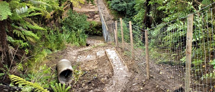
Linton Watercourse and Stormwater Network Realignment
In 2021 MAP Projects completed a swale diversion project for Linton Military Camp. The diversion was required to enable future vertical construction within the camp. Key to the project was the excavation and shaping of 400 metres of swale nearing five metres deep...
-
 Read more
Ardmore Military Training Area Boundary Fence Upgrade
In early August 2020 MAP Projects finished the construction of some 13km of deer fencing along the Ardmore Military Training Area (AMTA) boundary and a fully automated gate at the entry to the training facility, for the New Zealand Defence Force.
This was a project in support of impending statutory requirements for the Auckland Council’s regional pest management plan and to improve security of the training area.
The area covers a large area of hard, steep terrain that runs through dense bush and the occasional boggy creek...